Natural wonders of Argentina
Through time and the history of our country, we have been able to recognize in its extensive geography the prodigality of its lands. Its biological and cultural diversity constitutes the heritage of the entire society. But there were great visionary men who, beyond contemplating and knowing the natural wonders of our territory, tried to preserve it as a legitimate legacy for future generations.
Francisco Pascasio Moreno, explorer, statesman and scientist, was one of the main architects and pioneer in America. The expert Moreno gathered the scientific information and the geographical verifications in the Patagonian area, which allowed, in 1902, to resolve the border conflicts with Chile and to strengthen Argentine sovereignty over a territory of 40,000 km². For his contribution, the government gave him possession of land in the south. However, his spirit led him in 1903 to cede them to the Nation “for the best benefit of present and future generations.” In the donation letter, he emphasized: “I have come to request the location of an area of three square leagues in order for it to be conserved as a public park. By making this donation, I express the wish that the current physiognomy of the perimeter it encompasses will not be altered and that no more works be done than those that facilitate comfort for the visitor’s life”.
Thus, in 1922 the Parque Nacional del Sur was created and in 1934, together with the National Park Service, the Iguazú and Nahuel Huapi Parks were born, the latter located on the basis of the original Parque Nacional del Sur. The gesture of the expert F. Moreno allowed Argentina to become the third country in America to have a National Park.
Currently, the National Parks Administration is the government agency in charge of protected natural areas. In terms of conservation and administration of these areas, both the provinces and the nation made complementary efforts. Proof of this is the creation of the Campo de Los Alisos National Parks in 1995, Los Cardones and Quebrada del Condorito in 1996, Talampaya in 1997, San Guillermo in 1999, Mburucuyá and Copo in 1998, in addition to those that are in the process of being created.
Among the objectives pursued by the management of National Parks is not only that of guaranteeing the conservation of the natural heritage, but also that of radiating sustainable management practices and presenting a national and international tourist attraction, in addition to providing direct and indirect environmental services. of incalculable value to society as a whole. The goals are defined around the conservation of biodiversity, the protection of the habitat of endangered species, the protection of cultural diversity, the protection of paleontological and archaeological sites, and the promotion of education and research.
The Protected Natural Areas are not considered as “conservation islands” but as a part within the regional context. If they did not exist, these environments would probably be abandoned to the laws of the market and to the greater or lesser “ecological” awareness of political and economic agents, they would suffer constant deterioration and the progressive loss of their natural and cultural resources. Within these spaces, the natural landscape is one of its main values and it is organized under recreation and tourism criteria, becoming a model on how to integrate public use with in-situ conservation strategies.
Los Glaciares National Park
With the spirit that guided the creation of the National Parks, it was inevitable that one of the most sublime natural monuments of Argentine nature…
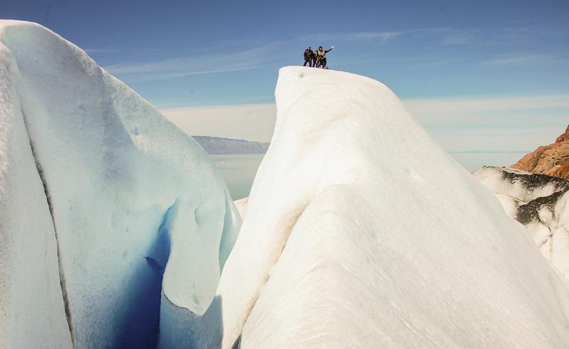
Los Glaciares National Park was created in 1937, with the foundation of protecting an extensive area of continental ice and glaciers spread over more than 600,000 hectares, in the southwest of the province of Santa Cruz.
It is enough to look at the images, to present part of the captivating beauty that personifies this ice landscape.
Due to its attractiveness, its glaciological and geomorphological interest, and part of its fauna in danger of extinction, UNESCO declared the glaciers a World Heritage Site in 1981.
Los Glaciares National Park encompasses a setting of mountains, lakes and forests, including a large part of the Andes Mountain Range frequently covered with ice and snow to the west and the arid Patagonian steppe to the east.
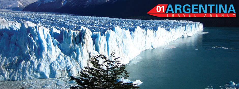
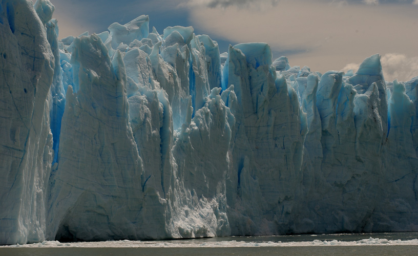
But without a doubt, the attention is dominated by the Patagonian ice field, whose mantle is the largest in the world after Antarctica. The fields, also known as Patagonian continental ice, occupied a total area of approximately 2,600 km² and represent more than 30% of the protected space. 47 major glaciers break off from these icy expanses, 13 of which flow into the Atlantic basin. There are also, independent of the ice field, 200 glaciers of smaller magnitude.
Cold goliaths
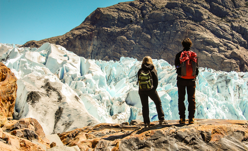
This unique southern wonder has unusual glaciological characteristics: unlike other formations that originate at 2,500 meters above sea level, the origin of these glaciers occurs at 1,500 meters above sea level. and descends to 200 meters above sea level, offering unique access and viewing in the world.
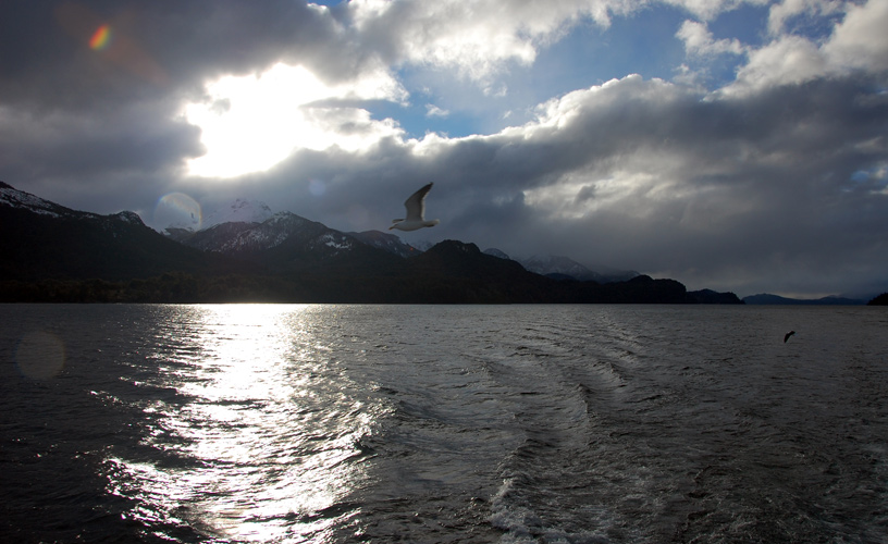
Formed by the melting of this vast system, two large lakes, Argentino and Viedma, pour their waters into the Atlantic Ocean after crossing the entire province of Santa Cruz through the homonymous river.
The Argentino Lake is the scene of the confrontation of two giants: the Perito Moreno glacier and the Upsala glacier.
The best known, the Perito Moreno Glacier, owes its fame to the continuous movement of its masses, produced by a cyclical phenomenon of advance and retreat, with spectacular landslides from its colossal 5 km front and its height of 60 meters above sea level. lake. Surprising and curious is its continuous translation, which causes the accumulation, fracture and detachment of cyclopean blocks of ice. With the shrillness of thunder, the moles plunge into fragments and sail through the Canal de Témpanos.
Every three or four years, the gradual breaking and subsequent leveling of the waters of the lakes leaves those who come to witness it speechless and breathless.
At the antipodes of Perito Moreno, located in the northern arm of Lake Argentino, Upsala is 50 km long and almost 10 km wide. Within the northern sector of Los Glaciares National Park, the Fitz Roy massif, with its 3,375 m high, and the Torre hill, at 3,102 m, reign impassively over the highest peaks of the surrounding ranges and present the greatest diversity of granite formation. of the mountain range.
Forest Creatures
Guarded by mountains and glaciers, the subantarctic forests occupy around 79,000 hectares, where the lenga and sour cherry predominate. Because it better resists low temperatures, the lenga is the one that comes closest to the glaciers and its forests also cover the bottom of the valley. In contrast, sour cherry, with characteristics very similar to coihue, is better associated with the oceanic climate and is less tolerant to thermal amplitudes.
Among the bushes, the notro, with its red flowers, the calafate with yellow flowers and violet fruit, and the elderberry of the devil in the most humid areas of the forest, beautify with its colors. We also find ferns, mosses, lichens and flowers such as the slipper-shaped topa-topa and orchids. Blue peas grow and cover the areas near the glaciers and the Antarctic pinguicula, a kind of carnivorous plant with purple flowers, attracts insects to digest them and obtain the nitrogenous substances necessary for their nutrition.
During the winter, the huemul descends from the high altitude grasslands to the forests in search of food and shelter.
The great diversity of birds, including the Patagonian black woodpecker, the southern parrot and the maroon-crowned hummingbird, includes black-necked swans and ducks such as the great grebe and the torrent grebe in the aquatic environments.
Above the forests, from an altitude of 1,000 m and up to the permanent snow limit located at 1,600 m, the high altitude semi-deserts extend. To the east, the foothills of the Andes blur into the Patagonian plateau, where the forest gives way to the steppe, with low, compact grasses. Guanacos, gray foxes and Patagonian skunks live there. Among the birds of the steppe, the great runner is the short-toed rhea.
Important populations of condors and shielded eagles nest in the northern sector of Los Glaciares National Park.
Vestiges of the past
Archaeological investigations indicate that three thousand years ago, the Lake Argentino region was inhabited by groups of hunter-gatherers, agile and capable of taking advantage of the spaces located both in the steppe and in the forest at variable heights from 200 to 1100 meters above sea level. Their subsistence resided mainly in the exploitation of the guanaco, in addition to using the various environments in a complementary manner at different times of the year. Likewise, materials from the Pacific Ocean have been discovered, which presupposes direct access to these areas or the existence of exchange networks.
In this remote place of Argentina, nature overflowed its magnitudes to continue to amaze us and force us to think about our finite human existence.
Tours:
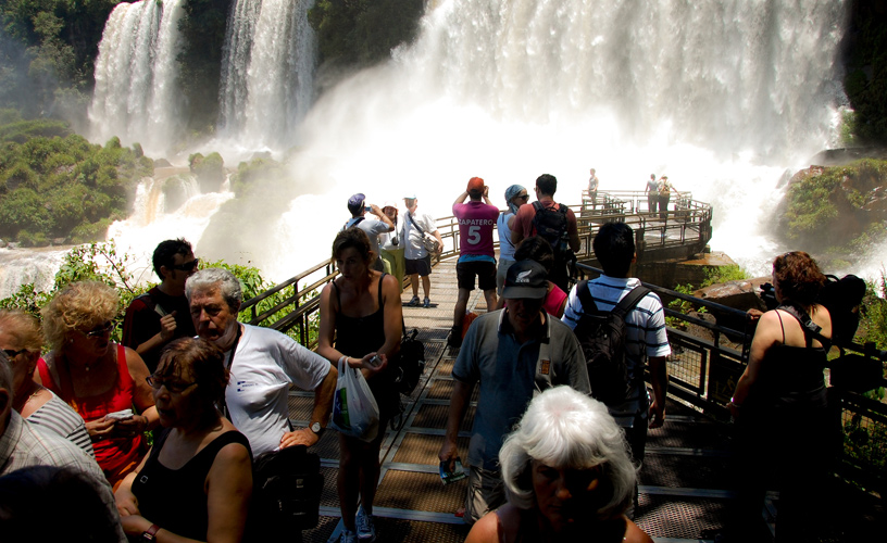
-Lacustrine excursions are made by the Argentino Lake that depart from Punta Bandera and allow to know Onelli Bay and the Upsala Glacier.
-Through the Brazo Rico vehicular path, you can access the viewpoints and footbridges of the Perito Moreno glacier, with a spectacular view.
-Cerro Chaltén (Fitz Roy), 3,375 meters high, is a meeting place for climbers from all over the world with expeditions of a high professional level, which must be authorized by National Parks.
-Sport fishing enthusiasts can enjoy introduced species in Lago Roca, Viedma, Lago Argentino and Las Vueltas River.
Los Glaciares National Park
Address: Av. Libertador 1302.
(9405) El Calafate – Santa Cruz – Argentina.
Phone: 54 2902 49100 / 49175 / 491026.
How to get there: From the north along National Route No. 3 to Río Gallegos, continuing along Provincial Routes No. 5, National No. 40 and Provincial No. 11 to the town of El Calafate, 50 km from Los Glaciares National Park. From El Calafate we arrive at the town of El Chaltén 316 km away, in the northern part of the protected area.
By plane you can access from Buenos Aires to Río Gallegos, and from there local flights leave for El Calafate.
To take into account: The Los Glaciares National Park Intendancy is located in El Calafate. Both this town and El Chalten offer inns, hostels and tourist cabins. For camping, there are designated areas in Lake Argentino and Lake Viedma, near El Chaltén, such as the Río Blanco or Cerro Torre base camps.