They are two Provinces that we should all visit at some point in our lives. Visit Salta & Jujuy. Such is the case that the influx of tourists arriving in these lands is very high.
Salta
The bars in Plaza 9 de Julio, the cable car of the San Bernardo hill, the Quebrada de San Lorenzo and the night clubs make Salta capital a must-see stop.
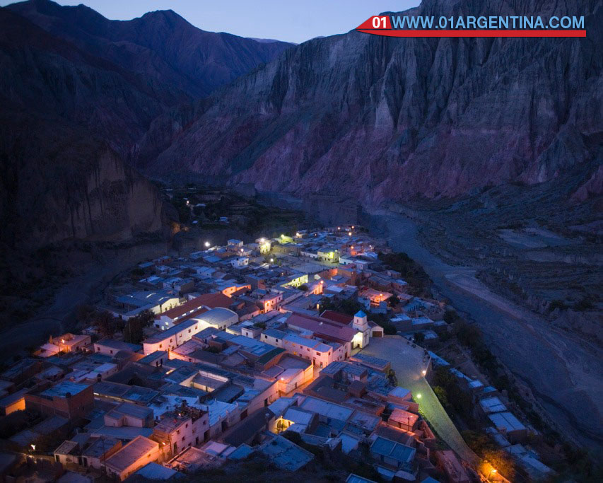
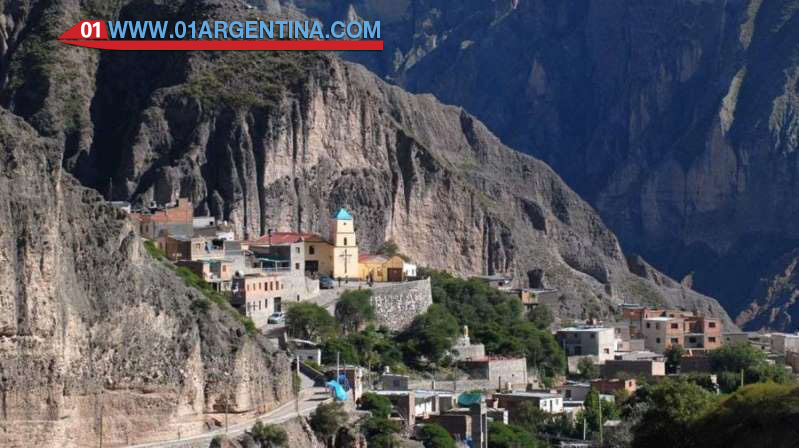
Visit Iruya that integrates the Salteño treasures and invites you to sleep in lodges in steep streets of irregular cobblestones, eat fried goat cheese empanadas and visit neighboring San Isidro by the riverbed.
Emblem of serenades and great trails between the hills like the one that leads to the Garganta del Diablo waterfall, Cafayate is first and foremost synonymous with vineyards, and two museums in its name confirm this.
The pianitos of the RN 40 to San Antonio de los Cobres are classics like some zambas that were born there.
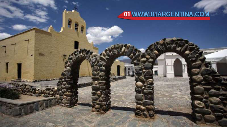
Cachi, head of the Calchaquíes valleys, invites one of the oldest churches, a clean and mighty river, the agriculture of Cachi Inside and archaeological sites of the Pular and Payogastas cultures.
Jujuy
So wonderful are the 170 km of multicolored villages that when in 2003 UNESCO decided to include the Quebrada de Humahuaca as a World Heritage Site, it had to create a new category which it called “Cultural Landscape”.
In the center of the Quebrada, Humahuaca waits with adobe houses and narrow streets where tamales and humitas come out warm.
On the other side of the Gorge, the Yungas show another face of Jujuy. Calilegua with native flora and fauna and old Inca trails, certify it.
San Salvador, provincial capital, shows its fertile valley at the confluence of the Grande and Xibi Xibi rivers, which is why it is recognized as Tacita de Plata. Its market, the main church and several museums stand out.
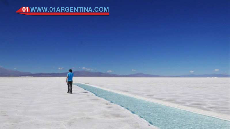
The Salinas Grandes make up the third largest salt flat in South America. Its immense white plain reaches the horizon. To get there you must cross the impressive Cuesta de Lipán with its beautiful landscapes.
Attractions of National Route 40 in Salta
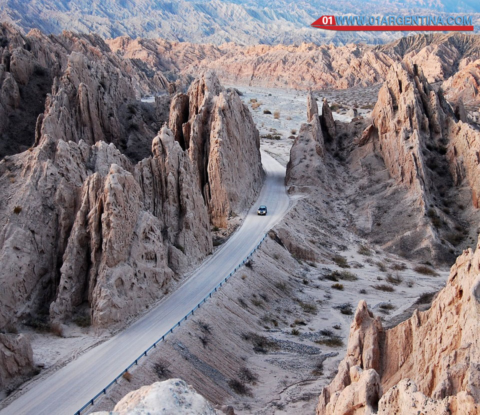
Imposing natural formation in the Calchaquí Valleys: they are eroded rocky rocks of brown, gray and whitish color, that protrude from the ground in overlapping strata that resemble “arrows”.
What is the Quebrada de las Flechas?
In the heart of the Calchaquí Valleys, Route 40 crosses a lunar landscape:
• Strange-looking rock formations that protrude up to 50 m above the ground; is the Quebrada de las Flechas
• The color of the sandstone ranges from an ash color to an ocher – reddish
• Its appearance is that of a rocky puff pastry, with sharp arrows arranged in sloping layers, overlapping and crooked layers
• The Natural Monument has many streams with gorges and vertical walls. Light and shadows give it a different look according to the time of day
• They are protected under the name of Angastaco Natural Monument
When to travel to the creek?
Autumn, Spring and Winter (although it is cold) are the best times to visit the area:
• Summer. Rainy period, sometimes torrential that can cut the trace of the route and prevent circulation. The height mitigates the heat.
• Winter. Dry period, it hardly rains. Cold weather and even colder night. The height makes the cold more noticeable. Bright sun.
• Fall and Spring. As of March and before November, it hardly rains. Nice day. Cold at night. The height makes the cold more noticeable. Bright sun.
Tips and Tips to Visit the Region
- Climate: in the Calchaquí Valleys
Dry climate zone with low relative humidity. The rainy season is summer (Nov to March). There is great thermal amplitude between day and night.
The sky is usually clear and the sun is strong (use sunscreen). In winter it is cool and cold, but it does not snow. - Height and aiming
At heights greater than 2,000 meters such as those in the area north of the Quebrada de las Flechas (Cachi for example), unpleasant symptoms known as Pointing or Soroche (altitude sickness) can occur. It is caused by lower atmospheric pressure and this means that there are fewer air molecules (and less oxygen) in the same amount of air.
Lack of oxygen can cause nausea, dizziness, headache, fatigue and tiredness. - Precautions
This section of the road is gravel road – gravel and sand, in the mountains: winding and narrow.
We recommend checking the state of the route before traveling.
Vados, dry channels and summer rains
Since in summer torrential rains occur in the hills that wash rocks, mud and bushes on the route. Observe the 45 ° walls that leave the bank to the north in the final section of the Quebrada near Angastaco: they are to divert the waters of the route), it is convenient to circulate with caution before a sign of rain in the mountains.
Important, rains: If it rains in the mountains the waters will fall like torrents through the streams. Even if it does not rain on the route it may be raining on the summits. Drive carefully.
Important Tips
• Bring water and food. A map in paper format.
• Sometimes, Route 40 may be closed due to landslides or landslides. Especially in the summer rainy season.
• Wear appropriate clothing for the thermal amplitude between day and night.
Gravel In the rubble parts drive with caution.