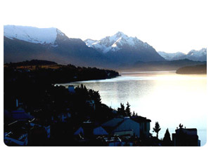
ANDEAN PATAGONIA
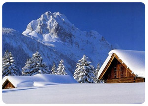
High, show-packed peaks, a perfect white volcano mirrored in a still lake, chalk-white glacial streams cascading over polished granite, meadows filled with chin-high pink and purple lupine, fast-flowing rivers, and thousands of lakes, with no houses, no piers, no boat: Could this be paradise on earth?
Andean Patagonia’s northern Lake District seems like one big national park: The Parque Nacional Lalín, just north of San Martín de los Andes in Neuquén Province, combined with the neighboring Parque Nacional Nahuel Huapi, in Río Negro Province, with Bariloche as its head quarters, ads up to 2.5 million acres of natural preserve about the size of New England. South of the Cholila Valley and northwest of Esquel is the Parque Nacional los Alerces, named for ots 2,000 year old alerces (fitzroya cupressoides), which are similar to California redwoods. The park covers 1,610 sq Km (1,000 sq mi) of true wilderness, with only one dirt road leading into it.
 |
 |
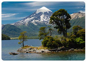
Along the eastern edge of the northern Lake District, mountains streams flow into rivers that have carved the deep canyons with fertile valleys. Welsh farmers have been growing wheat and raising sheep in the Chubut Valley since 1865. Rain diminishes as you move eastward, and the land flattens into a great plateau, running eastward into dry, desolated Patagonia. This is sheep-breeding country and Benetton owns a large portion of it. In summer (December-March), the towns of El Calafate and El Chaltén, in the southern Lake District, come alive with the influx of visitors of the Parque Nacional Los Glaciares and climbers headed for the Cerro Torre and Monte Fitzroy.
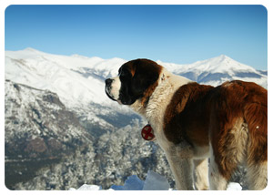
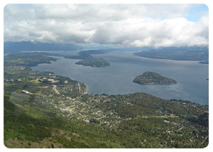
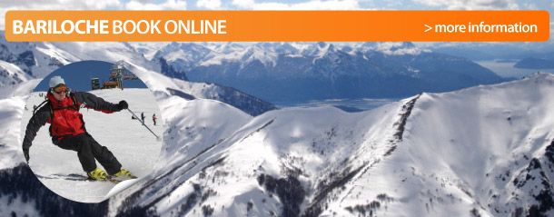
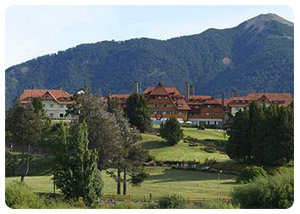
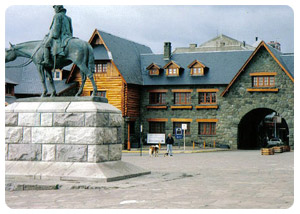
BARILOCHE
Bariloche is located 1,615 Km (1,001 mi) southwest of Buenos Aires (2 hrs by plane), 432 Km (268 mi ) from Neuquén on R 237, 1,639 Km (1,016 mi) from Río Gallegos, 876 Km (543 mi) from Trelew, 357 Km (221 mi) from Puerto Mont, Chile.
In 1620, the Governor of Chile sent Captain Juan Fernandez and his troops across the Andes in search of the Enchanted City of the Caesars, a mythological city alleged to be somewhere in Patagonia. The Jesuits established a mission on the shores of the lake, near what is now Isla Huemúl. Until the 1720´s they attempted to convert the Tehuelches, who were very warlike and ultimately massacred the missionaries, including the mission’s founder, Father Mascardi.
No Europeans again visited the area until the next century, when Captain Cox arrived by boat from Chile in 1870, and later in 1876 perito (expert) Francisco Moreno led an expedition from the Atlantic, thus becoming the first explorer to arrive from the East.
Most of the indigenous people of the area were brutally massacred during the infamous Campaña del Desierto (Desert Campaing, 1879-1883). Setters then felt safe to colonize and fort (called Chacabuco) was built at the mouth of Río Limay in 1895. Swiss, German, Scandinavian, and northern Italians found a rugged and relatively unexplored land similar to their Alpine homelands. They skied and climbed the mountains, fished in nearby lakes and streams, and built chalets in town and along the shore of Lago Nahuel Huapi.
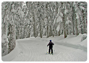
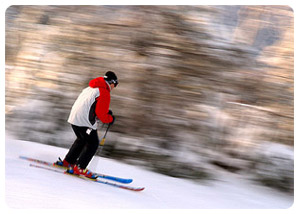
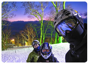
Bariloche’s first tourists stayed in a hotel by Carlos Wiederhold called La Cuchara Sucia (The Dirty Spoon). By 1924 tourists traveled two days from Buenos Aires by train, then drove 560 Km (350 mi) on dirt roads. The railway finally reached Bariloche in 1934, and by 1938 people from all over the world came to ski on the slopes at nearby Cerro Catedral.
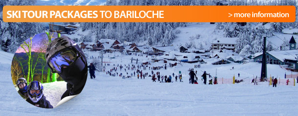
These days Bariloche has all the comforts and conveniences of a resort town, and is the gateway to the recreational and scenic splendors of the northern Lake District. Though plane, buses, trains, boats, and tour groups arrive daily, once you’re away from town, you can generally find a spot where you seem to be the only person in the world.
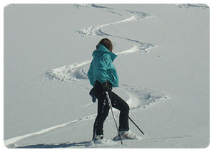
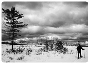
The best way to escape into the stunning wilderness of clear blue lakes, misty lagoons, rivers, waterfalls, mountains glaciers, forests, and flower filled meadows is by mountain biking, horseback riding, or hiking. Or by going fishing is one of the 40 nearby lakes and countless streams. It’s possible to get around on your own with a rented car or to go on a planned excursion with a local tour company.
The Parque Nacional Nahuel Huapi
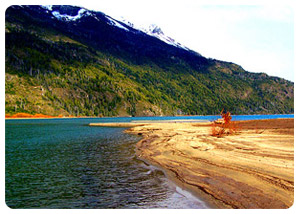
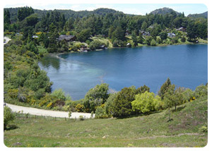
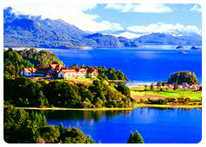
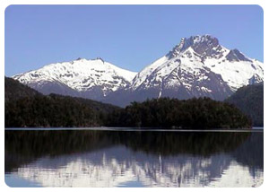
Created in 1943, is Argentina’s oldest national park, and Lago Nahuel Huapi is the sapphire in its crown. The park extends over 2 million acres along the eastern side of the Andes in the provinces of Neuquén and Río Negro, on the frontier with Chile. It contains the highest concentration of lakes in Argentina. The biggest is Lago Nahuel Huapi, a 897 sq Km (557 sq-mi) body of water, whose seven long arms (the longest is 96 Km (60 ft) long, 12 Km (7 mi) wide) reach deep into forests of coihue (a native beech tree), cypress, and lenga trees. Intensely blue across its vast expanse and aqua green in its shallow bays, the lake meanders into distant lagoons and misty inlets where the mountains, covered with vegetation at their base, rise straight up out of the water to lofty heights. Participating in every water sport invented and tours to islands and other extraordinarily beautiful spots can be arranged through local tour office, outfitters, and hotels. Throughout the park are also information offices where you can get help in exploring the miles of mountain and woodland trails, Lakes Rivers, and streams.
 |
 |
The most popular excursion on Lago Nahuel Huapi is by boat to Isla Victoria (Victoria Island), the largest in the lake. A grove of redwoods transplanted from California thrives in the middle of the island. After a walk on trail that leads to enchanting views of emerald bays and still lagoons, the boat crosses to the tip of the Quitruihué Peninsula for a visit to the Parque Nacional Los Arrayanes.
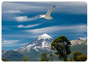
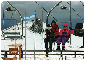
The renowned ski area at Cerro Catedral (Mt. Cathedral) is 46 Km (28 ½ mi) west of town on Avenida Ezequiel Bustillo (R 237); turn left at Km 8 ½ just past Playa Bonita. The mountain was named for the Gothic looking spires that crown its peaks. Though skiing is the main activity here, that view from the top of the chairlift at 6,600 ft is spectacular any time of year. Looking northwest, the intense blue of Lago Nahuel Huapi meanders around islands into invisible bays and disappears beneath mountains and volcanoes miles away, with Lanín Volcano visible on the horizon.
 |
 |
You can reach the summit of Cerro Otto (Mt. Otto; 4,608 ft), another fine ski area, by hiking, mountain-biking, or driving 8 KM (5 mi) up a gravel road from Bariloche. Hiking to the top of the mountain takes you through a forest of lenga trees to Argentina’s first ski area at Piedras Blancas. Here Herbert Tutzauer, Bariloche’s first ski instructor, won the first ski race by climbing the mountain, then skiing down in through the forest in one hour and 30 minutes. Or you can take the Teleférico Cerro Otto, 5 Km (3 mi) west of town; a free shuttle bus leaves from the corner of Mitre and Villegas, and Perito Moreno and Independencia; the ride to the top, a revolving cafeteria with a 360 degree panorama takes in Mt. Tronador, lakes in every direction, and Bariloche. In winter, skis and sleds are available for rent at the cafeteria. In summer, hiking and mountain biking are the main activities. For a real thrill, try soaring out over the lake with the condors in a para-plane.
A visit to Monte Tronador (Mt. Thunderer) requires an all day outing of 170 Km (105 mi) round trip from Bariloche. The 12,000 ft extinct volcano, the highest mountain in the northern Lake District, sits astride the frontier with Chile, with one peak on either side. Take R 258 south along the shore of Lago Gutierrez; from here you can see Cerro Catedral.
The road continues along the shore of Lago Mascardi. Between the two lakes the road crosses from the Atlantic to the Pacific watershed. At Km 35, turn off onto a road marked TRONADOR AND PAMPA LINDA and continued along the shore of lago Mascardi, passing a village of the same name. Just beyond the village, the road forks and you continue on a gravel road, R 254.
Near the bridge the road branches left to Lago Hess and Cascada Los Alerces a detour you might want to take on your way out. Bearing right after crossing Los Rápidos Bridge, the road narrows to one direction only: It’s important to remember this when you set out in the morning, as you can only go up the road before 2 Pm and down it after 4 Pm.
 |
 |
The lake ends in a narrow arm (Brazo Tronador), at the lovely Hotel Tronador, which has a dock for tours arriving by boat. The road then follows the Río Manso (Manso River) to Pampa Linda, which has a lodge, restaurant, park rangers, office, campsites, and the trailhead for the climb up to the Refugio Otto Meiling at the snowline. Guided horseback rides are organizer at the lodge. The road ends 7 Km (4 mi) beyond Pampa Linda in a parking lot that was once at the tip of the now receding Glaciar Negro (Black Glacier). As the glacier flows down from the mountain, the dirt and black sediment of its lateral moraines is ground up and covers the ice. At first glance, it´s hard to imagine the tons of ice that lie beneath its black cap.
 |
 |
The detour to Cascada Los Alerces (Los Alerces Falls), 17 Km (10 mi) from the turnoff at the bridge, follows the wild Río Manso, where it branches off to yet another lake, Lago Hess. At this junction you find a campground, refuge, restaurant, and a trailhead for the 1,000 ft climb to the falls. The path through dense vegetation over wooden bridges crossing the rushing river as it spills over steep rocky cliffs is a grand finale to day of viewing nature at its most powerful and beautiful.
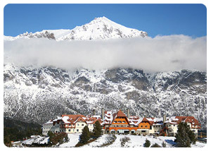
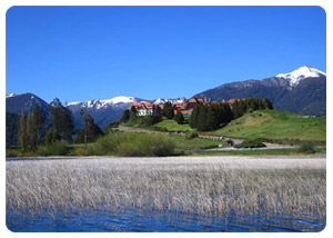
Another excursion from Bariloche is the Circuito Chico (Small Circuit), a half-day, 70 Km (43 ½ mi) scenic trip along the west shore of Lago Nahuel Huapi. You can do it by car, tour bus, or mountain biking. First head west on Avenida Bustillo (R 237) toward Península Llao Llao. At Km 20, you can take a brief side trip to the Península San Pedro, a 11 Km long (7 mi-long) appendage running parallel to the coastal road; this dirt road passes some fine homes set back in the woods. At the Ahumadero Familia Weiss (Weiss Family Smokehouse), along the way, you can buy smoked fish and game. Back on the main road, continue west to Puerto Pañuelo (Km 25 ½) in a little bay on the right; it’s she embarkation point for lake excursions and for the boat crossing to Chile. Across from the port, a long driveway leads up a knoll to the Hotel Llao Llao, which is worth a visit even if you´re not staying there. The Circuito Chico now follows R 77 to Bahía Lopez, winding along the lake´s edge through a forest of ghostly, leafless lenga trees. After crossing the bridge that links Lago Moreno (Lake Moreno) and lago Nahuel Huapi at Bahía Lopez, the road crosses the Arroyo Lopez (Lopez Creek).
 |
 |
Here you can stp for a hike up to a waterfall and then climb above Lago Moreno to Punto Panorámico, a scenic overlook well worth a photo stop. Just before you cross Lago Moreno, an unmarked dirt road off to the right leads to the rustic village of Colonia Suiza, a good spot to stop for tea or lunch. After passing Laguna El Trebol (a small lake on your left), R 77 joins R 237 from Bariloche.
The Circuito Grande (Large Circuit), a more ambitious excursion, which is particularly lovely in spring or fall, covers 250 Km (155 mi). Along the way there are plenty of spots to stop and enjoy the view, have a picnic lunch, or even stay overnight. Leaving Bariloche on R 237, follow the Río Limay into the Valle Encantado (Enchanted Valley), with its magical red rock formations. Before crossing the bridge at Confluéncia (Where the Río Traful joins the Limay), turn left onto R 65 to Lago Traful. Five Km (3 mi) beyond the turnoff, on a dirt road heading toward Cuyín Manzano, are some astounding formations. As you follow the shore of Lago Traful, a sign indicates a mirador (look-out) on a high rock promontory, which you can climb up to on wooden stairs.
At Villa Traful, you can buy picnic supplies. In Villa Traful, stop for a break at Ñancu- Lahuen, a teahouse and restaurant with a luscious garden; it’s also a good place to get travel and fishing information. From here the road dives into a dense forest until it comes to the intersection with the Seven Lake Circuit; turn left, following the shore of Lago Correntoso to the paved road down to the bay at Villa La Angostura.
The circuito de los Siete Lagos ( Seven Lakes Circuit) is an all day trip of 36 Km (223 ½ mi) round trip, which could be extended to include an overnight in San martin de los Andes. Drive north on R 237 for 21 Km (13 mi), and turn left on R 231 to Villa La Angostura, 65 Km (40 mi) from bariloche. About 11 Km (7 mi) farther along the same road is the Seven lakes Road ( R 234), which branches right, and along the way passes Lago Correntoso, Lago Espejo, Lago Villarino, Lago Falkner, and Lago Hermoso. After lunch or tea or an overnight in San Martín de los Andes, head south to Bariloche on the dirt road over paso Cordoba, passing Lago Meliquina on the way. At Confluéncia, the road joins R 237, following the río Limay through Valle Encantado to Bariloche.
 |
 |
A longer, less traveled, all day boat excursion to Puerto Blest leaves from Puerto Pañuelo on the Península Llao Llao (accessible by bus, auto, or tour). The boat heads west along the shore of Lago Nahuel Huapi to Brazo Blest, a 1 Km long (3/4 mi-long) fjord like arm of the lake. Along the way, waterfalls plunge down the face of high rock walls. A Valdivian rainforest of coíhues, cypress, lengas, and arrayanes (myrtle) covers the canyon walls. After the boat docks at Puerto Blest, a bus transports you over a short pass to Puerto Alegre on Laguna Frías (Cold Lagoon), where a launch waits to ferry you across the frosty green water to Puerto Fíos on the other side. Mt. Tronador towers like a great white sentinel. The launch returns to the dock at Puerto Alegre, where you can return by foot or by bus to Puerto Blest.
A trail through the forest and up 600 steps to Cascada los Cántaros (Singing Waterfalls) is worth the effort. After lunch in Puerto Blest at its venerable old hotel, the boat returns to Bariloche. Note: This is the first leg of the Cruce a Chile por Los Lagos.
|